SearchPatterns Pro Sea app for iPhone and iPad
Developer: Adam Kusch
First release : 07 Dec 2012
App size: 1.49 Mb
Do you conduct Search and Rescue operations on a boat/ship?
Then this is REALLY the app for you!
Easily calculate various values to help you manage your search patterns.
PLUS have a map displaying the search area and your search pattern, and with GPS equipped iOS devices, you can see your current position as well!
Universal App!
Featured search patterns:
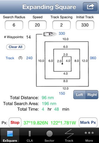
- Expanding Square
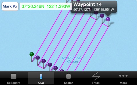
- Creeping Line Ahead (CLA)
- Sector Search
- Track Crawl
- Oil Field
For each search pattern, you can:
- calculate total distance of your search
- calculate how long it will take to conduct it
- calculate total square area searched
- calculate tracks
- view/calculate left or right patterns
- display the pattern on a map
- view a Full Screen map in Portrait or Landscape
- view current position with reference to the pattern
- view calculated waypoint Lat/Longs to enter into a search GPS
- mark your current position for where you left track or for a call-around/sighting/on-top
- enter a variation so you can enter all tracks in Magnetic but the pattern is still oriented True North on the map
- enter distances/speeds in: nm / sm / km / yards
- view bearing & distance to CSP from current position
- draw a line direct to the CSP from current position
- EXPORT the pattern as a .GPX file for use in other apps/Computer programs
- EXPORT your breadcrumbs as a .GPX file
in addition to:
Expanding Square:
- calculate number of waypoints needed to enter the pattern in a GPS
- tap on the graphic to highlight which legs you have completed (iPad only)
Creeping Line Ahead:
- calculate number of legs to fly based on a given the distance you need to creep (defined search area)
OR
- calculate the maximum distance you can cover based on a fixed amount of legs
Sector:
- use 60 degree or 30 degree cuts
- calculate subsequent tracks
Track Crawl:
- use bearing/distance or Lat/Long inputs to calculate subsequent waypoints
Oil Field:
- Calculate the pattern based on various angles
Email the developer for questions/comments/requests
Latest reviews of SearchPatterns Pro Sea app for iPhone and iPad
I work in the Coast Guard Auxiliary. I have been using the airplane version of this for a while now during search and rescue and love it. The developer has responded a couple times to requests and a bug that I sent him. Very nice! I just bought the boat version and am looking forward to trying it on the water.
Excellent app for SAR teams who work from marine vessels on water. The Oilfield pattern is especially useful for open water rescue. The programmer was/is very responsive to feedback and modifying the app. App is useful for training to illustrate patterns. Also great for instructors use to time exercises and how long a pattern will take to run.


